A favorite (and highly recommended) drive
If you're going to take a scenic drive around this beautiful area, Candee and I would recommend this route. The basic route should take approximately 3 1/2 hours, with a number of opportunities to stop for photos, coffee, a crumble or lunch. We would also recommend travelling a bit further to take a tour of Kylemore Abbey - gorgeous setting and compelling story. And, perhaps, one of the best cafes in the area.. Taking in Kylemore would probably add two hours to the trip.
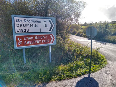
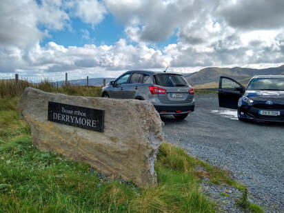
You'll head out of Westport on the Leenane/Clifden Road (N59). You'll drive approximately 9 kilometers (5.5 miles) before you'll see a sign on the right for Drummin and the Sheeffrey Hills (L1823).
You'll head out of Westport on the Leenane/Clifden Road (N59). You'll drive approximately 9 kilometers (5.5 miles) before you'll see a sign on the right for Drummin and the Sheeffrey Hills (L1823).
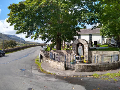
After you make the turn, you'll be driving through some rural residential areas, mostly farm country. After approximately 7 km you'll come upon the Catholic church in the small village of Drummin. Make a hard right, skirting closely the church property.
You'll continue along on this small road for quite awhile, constantly climbing in elevation. If you've not been to Ireland before, you'll wonder how two vehicles going in an opposite direction might pass one another. on such narrow roads. Here's the key - frequently along small roads there will be places to just edge enough off the road to let one another pass. You'll quickly get used to it. If you want to feel like an Irish person, salute the person as you pass. Here's how - with your hand on the steering wheel, simply raise your index figure as you pass. You'll be greeted similarly..
Once you get past the residential areas, you'll be surrounded by ancient fields and hills, mostly populated by nothing but sheep. If you look on your right, you will be able to see the small white chapel which sits atop the holy mountain of Croagh Patrick (pronounced Crow Patrick). It's known locally as the "Reek." If you have the fitness (and the courage...), you might consider climbing to the top for absolutely breathtaking views of Clew Bay and the surrounding mountains. The Reek is accessed for climbing from Murrisk (pronounced (Mursk) along the Westport/Louisburgh road.
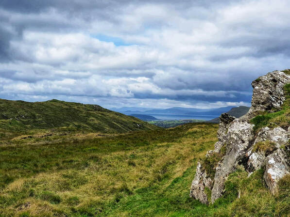
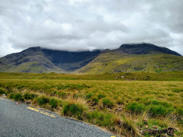
As you continue along you'll crest a hill at which you'll have a 360 degree panoramic view of the area. Directly ahead of you, you'll get a glimpse of Clew Bay, Clare Island, and Achill Island in the far distance. Croagh Patrick will be on the right, the mountains of Sheeffrey Pass will be on your left. This area is approximately 6 km past the church.
Once you get past the residential areas, you'll be surrounded by ancient fields and hills, mostly populated by nothing but sheep. If you look on your right, you will be able to see the small white chapel which sits atop the holy mountain of Croagh Patrick (pronounced Crow Patrick). It's known locally as the "Reek." If you have the fitness (and the courage...), you might consider climbing to the top for absolutely breathtaking views of Clew Bay and the surrounding mountains. The Reek is accessed for climbing from Murrisk (pronounced (Mursk) along the Westport/Louisburgh road.
As you continue along you'll crest a hill at which you'll have a 360 degree panoramic view of the area. Directly ahead of you, you'll get a glimpse of Clew Bay, Clare Island, and Achill Island in the far distance. Croagh Patrick will be on the right, the mountains of Sheeffrey Pass will be on your left. This area is approximately 6 km past the church.
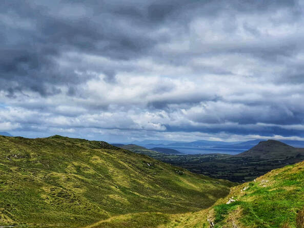
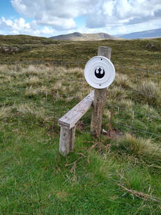
Get out of the car, experience the fresh and invigorating air, and take some snaps. If you're adventurous, you'll find a larger pull-off area where there's a simple wood structure to help you climb over the wire fence. Head up and to the left to access the best views. Watch where you walk and make sure to traverse the higher points - this is a boggy area and it will be easy to sink in some wet and mushy areas.
|
|
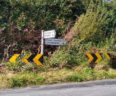
Back in the car, you'll go straight ahead, following the road to a T-junction. Make a right and follow the road down toward the bay. You'll quickly come upon another sign indicating a turn left to go to Louisburgh. Ignore it and continue straight.
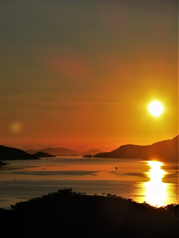
Soon you'll have close, high views of the bay. When you reach the end of the road, you'll turn left.. You'll be on the Westport to Louisburgh road and will be greeted with spectacular views of Clew Bay on your right. If you somehow get lost, you'll be asking for the way to Loooz-burg, not Lou-is-burg. The flat-topped Island in front of you is Clare Island, home of the legendary pirate queen Grace O'Malley - Granuaile (Gran -u-whale) - an historical figure who terrorized the west coast of Ireland, and who met Queen Elizabeth, refusing to bow since she considered herself an equal. Just beyond Clare Island begins the Atlantic Ocean.
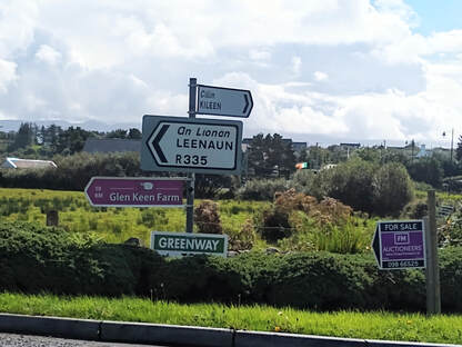
Louisburgh is a small charming town. You'll just be driving through on your way to your next stop - Doolough Valley - but feel free to stop and get a scone and a coffee in one of the town's many cafes. Just at the end of town, you'll cross a small bridge and take the first left turn (R335).
Louisburgh is a small charming town. You'll just be driving through on your way to your next stop - Doolough Valley - but feel free to stop and get a scone and a coffee in one of the town's many cafes. Just at the end of town, you'll cross a small bridge and take the first left turn (R335).
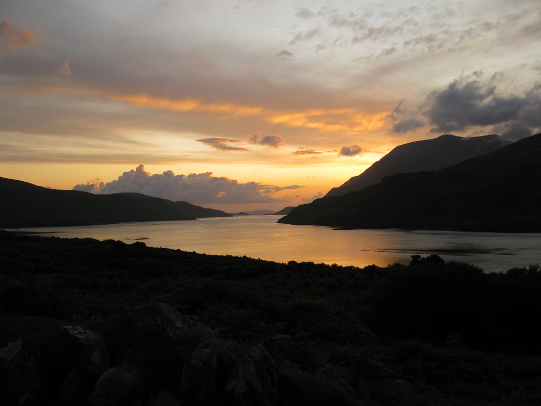
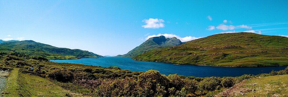
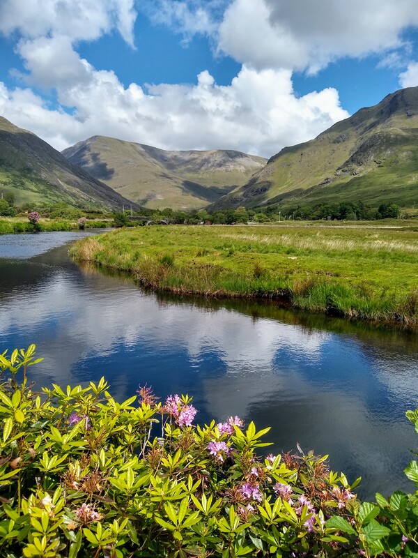
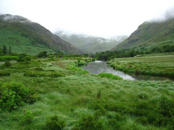
You'll be on this road for awhile (approximately 11 km), traversing a turning and twisting road (nothing heart-stopping). You'll see the mountains of Doolough Valley coming closer - a spectacular teaser for the stunning view you experience as you crest the hill and get an arresting glimpse of Doolough (black lake).
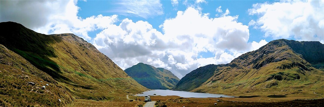
Doolough
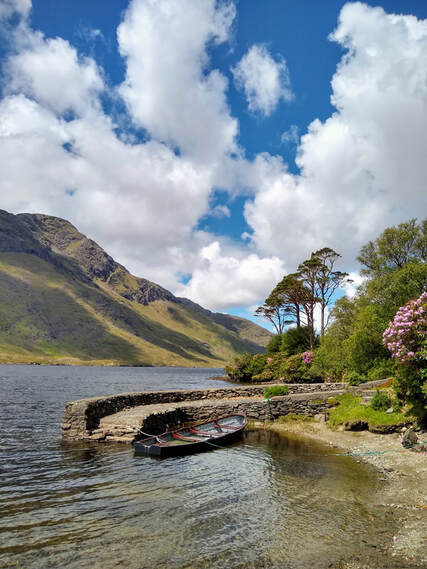
As you approach the lake, you'll see a carved stone cross on your left. It memorializes a terribly tragic event which transpired during "The Great Hunger" -the Irish Potato Famine of 1845 -49. You'll be driving down the leftside of the lake. Some areas will be a bit tight and you'll encounter lots of sheep. Again, nothing anxiety producing. You'll continue straight ahead, passing Delphi Lodge.
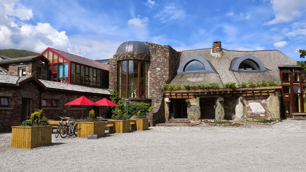
Continuing along, you'll pass the Delphi Adventure Resort (cool building looks like something out of The Hobbit). It's a good place to stop for a coffee or lunch. The river in front of the Adventure Resort can provide some beautiful photographs, regardless of the weather.
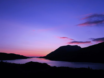
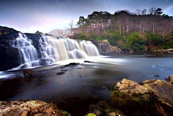
After passing the Delphi Adventure Center, you'll continue to go straight along. You'll reach Killary Harbor, Ireland's only fjord. The road will take you left and you'll drive along the fjord until you get to Aashleagh Falls, a small but picturesque waterfall of the Erris River.
After passing the waterfall you'll soon come to a T-junction - go right or go left. Going left will bring you back to Westport. We'd recommend going right and traveling at least as far as the "Misunderstood Heron" - a very well-regarded food truck (actually a former storage container). You might get a coffee and a snack there, but you're really there to look directly down Killary Fjord toward the Atlantic Ocean. Mweelrea - the tallest mountain in County Mayo - will be on the right as you look down the fjord, and, to orient you, Doolough would be just on the other side of the mountain. Mweelrea has a distinctive inverted cone at its summit - kind of looks like the remains of a volcano. Just a beautiful scenic spot.